How Arlington Made Sense of its Street Names and Paved the Way for Our First Federal Building
The 1935 Arlington County Directory of Street Names represents a unique moment in Arlington history-- a time when many Arlingtonians had to re-learn the names of their streets and those of their neighbors.
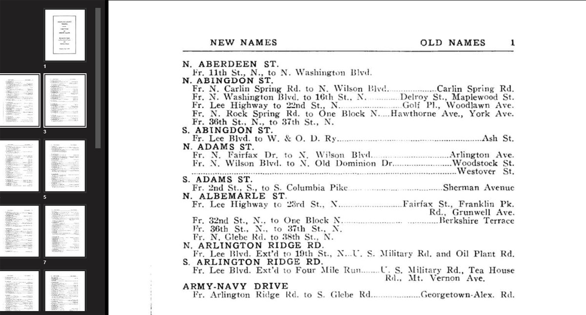
Page 1 from the Arlington County Virginia Directory of Street Names, 1935, screenshot of scanned document opened in the Community Archives.
In 1932, Arlington County had already begun a boom in population that would only continue over the next several decades. Between 1900 and 1930, the population of the once-rural area had grown by over 350%--from 6,430 to 23,278--despite the annexation of sizable portions of land by the city of Alexandria in 1915 and 1929.
New streetcar suburbs began popping up all around Arlington County--between 1900 and 1910 alone, plats for seventy new subdivisions were entered into the County Deed Books.
However, these new developments sprang up with little to no coordination or central planning, and by 1932, this was beginning to create problems. The developments formed what was, in effect, a confusing archipelago of small, unconnected towns, and street names were frequently repeated throughout the county. There were, by one account, as many as twenty-five different roads named "Arlington," for example, as well as many roads known as "Washington," "Virginia," and "Lee."
Visitors found the county difficult to navigate, neighborhood names had to be attached to mailing addresses to ensure that letters arrived at the right building, and some DC-area businesses even refused to deliver to customers in Arlington. There were also concerns about the Fire Department being dispatched to a house at the same address in the wrong subdivision.
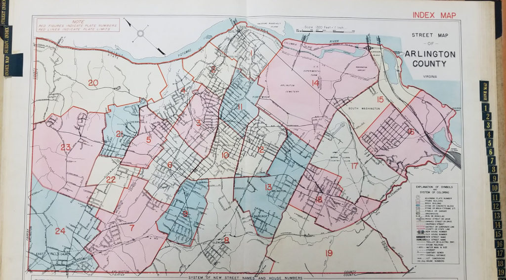
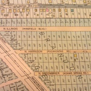
1935 Arlington County Franklin Insurance Property Atlas
The newly-established “County Board-County Manager” Government of Arlington decided very quickly to try to rectify this situation. One of the primary issues motivating them seems to have been the desire to see a Post Office in Arlington, as mail service to Arlington had been routed through Washington D.C. since 1925, and the Post Office Department had dictated that no Post Office would be allocated to Arlington until its street naming scheme was more coherent and logical. To this end, a Street Naming Committee was established, tasked with rationalizing the county's street naming scheme.
Initially, the committee considered simply eliminating duplicate street names, leaving one street with each repeated name. The committee quickly decided that this approach was insufficient, and that a more general, systemic plan was necessary. Soliciting feedback from the county’s residents, the committee got a variety of proposals, from continuing DC’s alphabetical/numeric scheme to having the residents of each street vote on a street name.
Eventually, the committee decided on essentially the county’s current street naming scheme:
- The county is divided into two sections, North and South Arlington, generally separated by Arlington Boulevard (US Route 50).
- Numbered streets generally run east-west, parallel to Arlington Boulevard, and North and South designations follow numbered street names.
- Named streets generally run north-south, and North and South designations precede named street names. These streets are generally named in alphabetical order from east to west, skipping the letters X, Y, and Z. When the end of the alphabet is reached, it is repeated with additional syllables-- thus Oak and Quinn Streets are to the east of Oakland and Quincy, which are in turn east of Ohio and Quantico Streets.
- Boulevards, Drives, and Roads are generally major thoroughfares with historically recognized names, most of which were not renamed. Generally, these are the only through streets, unlike numbered and named streets, which tend to be broken up at times and intended primarily for local neighborhood traffic.
The Committee’s recommendations were put forward for public comment, and were approved with several small amendments in August of 1934--thirty months after the project began. In 1936, Arlington County was assigned a local Postmaster for the first time in over ten years, and the next year, the Postmaster General of the United States of America was on hand for the dedication of the cornerstone of the new Post Office in Clarendon--the first federal government building in Arlington County.
For people researching Arlington before 1934, the street name change can present challenges. This searchable PDF of the Arlington County Virginia Directory of Street Names, which opens by clicking or tapping on the cover image, can help with navigation of Arlington before the change.
To learn more about Arlington's history, visit the Center for Local History on the first floor of the Central Library.
Do you have a question about this story, or a personal experience to share?
Use this form to send a message to the Center for Local History.
Center For Local History - Blog Post Message Form
Do you have a question about this story, or a personal experience to share? Use this form to send a message to the Center for Local History.
"*" indicates required fields


Thank you for the feature about about pre- and post-1934 Arlington street names. I was intrigued. I looked up my block and found that, for both the north-south stretch of N. Lincoln and the east-west stretch of N. 14th, the “new names” were listed in the left-hand column, but no corresponding “old names” were listed in the right-hand column. Is that because those streets(or rather street-segments) were only “lines on a map” in 1934, but had not yet been built in the real world? Or had the streets actually been built by 1934, but were called “N. Lincoln” and “N. 14th” from their inception? Thanks again.
Our Virginia Room researcher replies:
Unfortunately, reading this guide can be somewhat confusing. I had trouble finding the answer to your question myself, until I looked at an atlas from 1935, but once you know the old name, searching can sometimes be easier– which makes sense, as it was designed for people who were more familiar with the old names than the new.
Looking at the area around the intersection of Lincoln and 14th in North Arlington, it looks like N Lincoln St along that point was Gilman Ave and the area around that area what is now 14Th St N was called Ridgely St.
On the Northwest corner of that intersection, there was a small subdivision that was being built around that time by Roy R. Sprinkle. On the Northeast corner, out to the present location of Arlington Science Focus, were three larger lots belonging to the Ball and Lockwood families– Laurence Ball had two acres on the corner, and the Lockwoods had 8 acres further back, with their house approximately at the school’s present location… It’s a great reminder that even in the 30s, Arlington was still filled with larger multi-acre properties that intermingled with and often set apart other areas of high population density.
This is fascinating! Thank you for the informative look at our street names. I have to admit that my first response was, “You mean it used to be Worse?”! I vividly recall getting royally stumped once by Washington Blvd / Washington St(when Rte 29/Lee Hwy changes names in Falls Church) when I first came to the area — before GPS etc, of course.
And the standing joke is that our streets were just paved-over horse trails, curving all over the place.
I love that this is from so long ago that the threat was that Arlington just wouldn’t get a post office till the streets got more orderly!
Again, thanks.
You’ve gone to the trouble of writing a very interesting article on the naming of Arlington Streets, but never broach the conundrum of proximity of number streets and roads. It is the bane of all of us living on these roadways when we must give directions to delivery trucks and cabbies. We have to append our address to “11th Street-Not-Road.” Why was this difficulty not foreseen?
That’s a fascinating question, and I’m not sure what the answer is, though I’d be glad to share my theory. While there are several examples of numbered roads throughout Arlington, after a somewhat cursory look through an atlas of Arlington County from around the time of the name change, I’m really only seeing examples of this in the area west of the what is now the corridor of green space made up of Bon Aire, Bluemont, and Glencarlyn Parks.
In other words, it’s only in the westernmost tip of the county, in the area of East Falls Church.
My guess would be that the rationalization plan allowed for that to incorporate something from the street naming scheme of the town of Falls Church (still unincorporated and part of Fairfax County, but one of the most populous areas of the county). There was virtually no development between Ballston and Cherrydale to the east and East Falls Church to the west. For this reason, it might have made sense to allow the area to maintain an idiosyncratic naming scheme inconsistent with the rest of the county. Other examples from different parts of the county might have been named by developers after the street name rationalization, trying to remain consistent with the overall naming scheme but not being particularly creative.
Again, this is highly speculative, but it’s an interesting question and begs some further research. I’ll try to look into it further.
Yes, please do. This street and road conundrum has often seen me giving directions to a traveller driving up and down my block in Cherrydale, looking for a house number that can be found on 21st Road on the other side of Old Lee Highway. It seems to be an odd quirk in what is otherwise a very logical street naming system.
This is lovely, but is there any chance you can rescan page 7? It appears cut off and that’s where my street, North Oakland, would be. Thanks.
Paul-
I’ve tried viewing page seven in several different ways, on a couple different browsers, and I’m having trouble seeing where it might be cut off. Could you tell me how you’re viewing it: Slideshow, the PDF, etc? And what software and operating system are you using? I want to make sure this works for everybody!
For what it’s worth, here’s what I’m seeing for N Oakland:
From Pershing Dr. to 6th Rd. N –
Old Name: Huntingdon Ave.
New Name: Baker St.
From Wilson Blvd. to N. Fairfax Dr. –
Old Name: Frankfort Ave.
New Name: Wallis St.
From 18th St., N., N. to end –
Old Name: Baltimore St.
New Name: Floyd Pl., Dorsey St.
Hope that helps!
Thanks for a great article! Has the entire 1935 Atlas of Arlington County been digitized? Could you post it here? It would be easier and more fun to find a place on that map and see the old names than go through the booklet.
I live on N. Albemarle St. on a half circle on the north side of 23rd St. N., and our house was built around 1930.
I looked up N. Albemarle St. under “New Names”, and found “Fr. Lee Highway to 23rd Stl, N.”, which is just below our section of N. Albemarle St., and under the Old Names category it lists several names – Fairfax St., Franklin Pk. Rd., and Grunwell Ave..
So I’m confused – how do I know which name was the original for ours?
Thank you!
I am tying to find my Great Grandmom’s house in Cherrydale. Using your old and new name list I was able to locate where the street used to be. But how do I find the actual house, the address was 51 Fairfield St, Cherrydale, Va.
Why are some called streets and the others called roads?
Hi Joan,
We have a pamphlet titled “The Arlington County Street System Guide,” that explains the system, and which you can read in the Center for Local History.
But the short answer is:
– Named streets generally run north-south and are alphabetized starting at the Potomac River.
– Numbered streets generally run east-west, parallel to Arlington Blvd. When numbers are repeated, the designation sequence is street, road, place.
– Boulevards, Drives and Roads generally are diagonal and are major thoroughfares with historic names.
As you can see, it’s quite complicated!
This page has two broken links: one for the web applet at the top of the page, and the link behind the text “creating a searchable PDF”. Since I can’t find any information regarding historical street names in this page, I assume one or both of them actually contained the content this page intends to show.
Would someone please look into this? I’m researching family history and would find this very helpful. Thanks!
Barbara,
The image links are indeed super-broken. We will re-attach them as quickly as possible, but it may take us a bit of time.
In the meantime, you are welcome to come into the Center for Local History for more research help in person.